Men of the West Yorkshire Regiment and 10th Gurkha Rifles advance along the Imphal-Kohima road behind Lee-Grant tanks.
Kohima is situated on a ridge that runs roughly north and south.
From Imphal, the road proceeded further south and into Burma.

This was the route the Japanese intended to take to invade India from Burma.
If successful Operation U-Go could have opened the whole of India for the Axis to takeover.
The attack on Imphal and Kohima started in the spring of 1944.

A third division commanded by Lt Gen Sato headed for Kohima.
They did not believe that the Japanese could cross the nearly impenetrable jungles around Kohima in force.
So close was the fighting that soldiers threw grenades directly into each others trenches.

The mined tennis court and terraces of the District Commissioner’s bungalow in Kohima.
Photo credit: Imperial War Museum
View of the Garrison Hill battlefield.
The British forces sustained 12,500 casualties at Imphal while the fighting at Kohima cost them another 4,000 casualties.
The defeat at Kohima and Imphal was the largest defeat to that date in Japanese history.
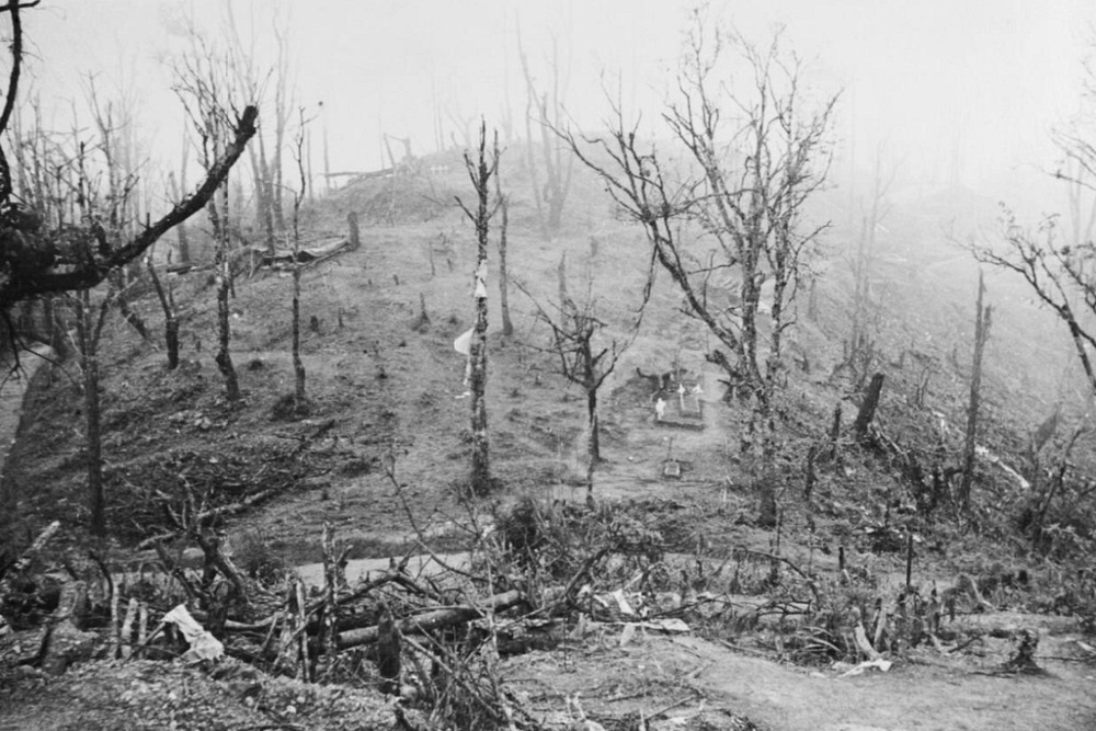
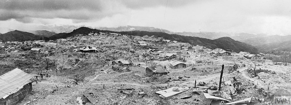
View of Kohima Ridge after the battle.
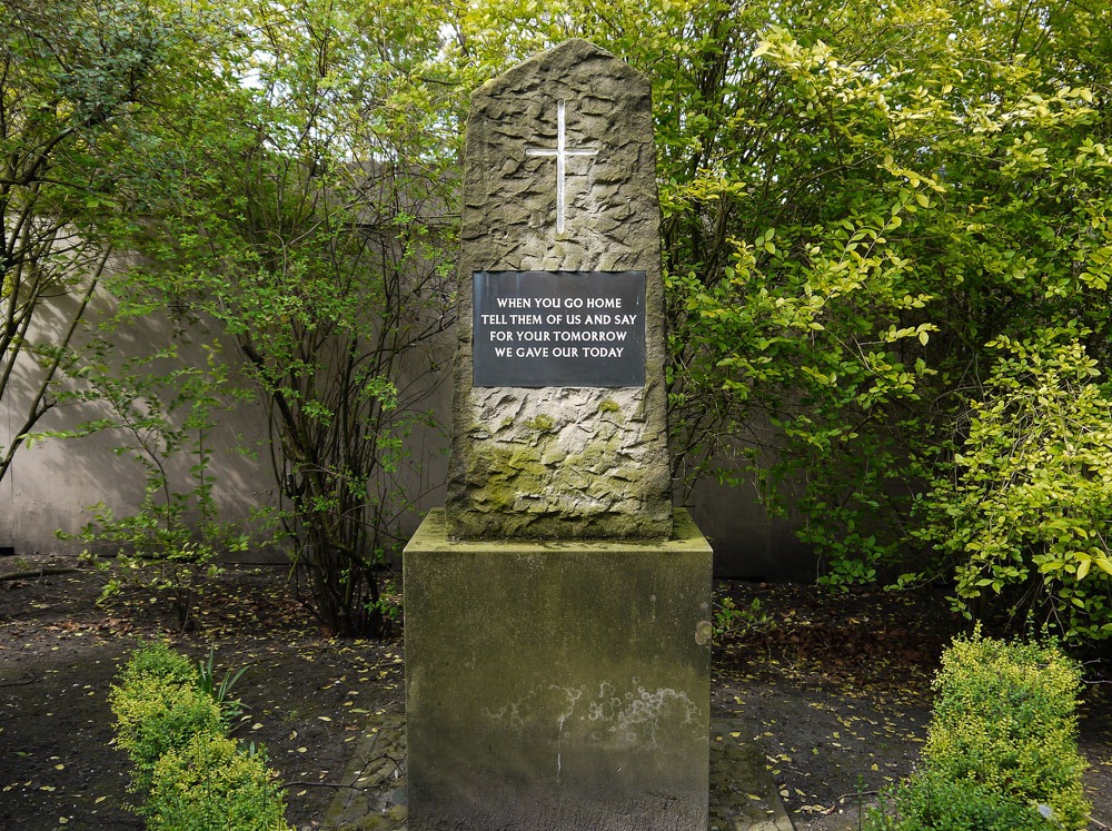
A large stone erected in memory of the 2nd British Division carries a beautiful epitaph carved on its face.
This so called Kohima Epitaph has since beenreproduced in numerousVeteran Memorials and Monuments throughout the world.
Photo credit: Imperial War Museum
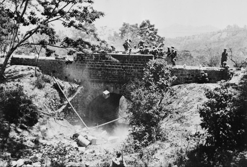
Men of the West Yorkshire Regiment clear a roadblock on the Imphal-Kohima Road.
Photo credit: Imperial War Museum
Kohima.
Treasury Hill and Assam Rifles Barracks are slightly left and the Naga Village extreme top left.
Photo credit: Imperial War Museum
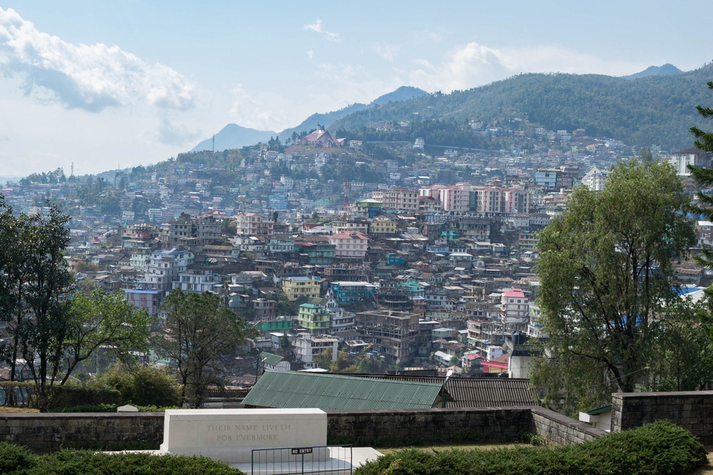
View of modern Kohima from the War Cemetery.
Photo credit:Shikha a/Shutterstock.com
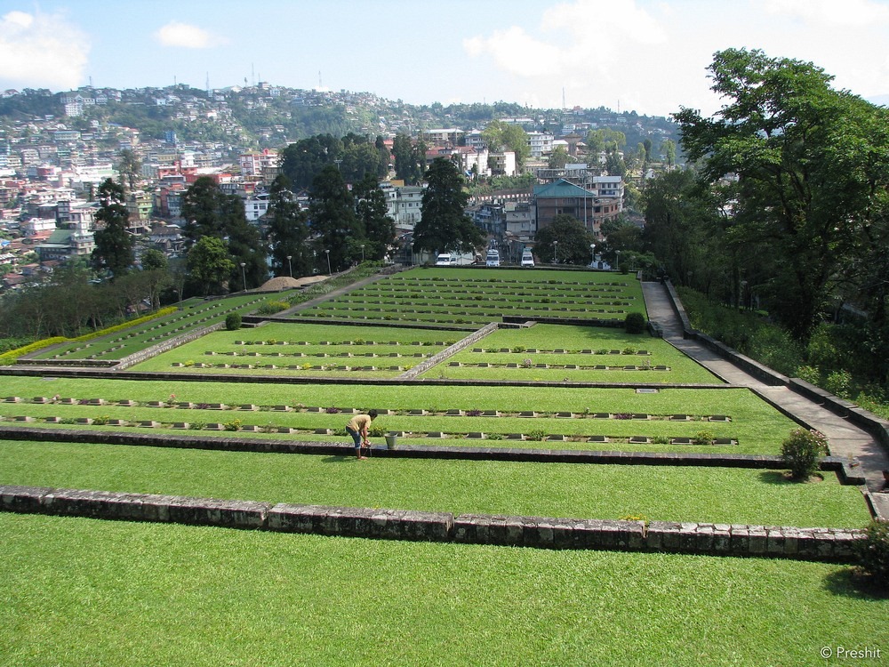
The War Cemetery in Kohima.

Photo credit:Preshit Deorukhkar/Flickr
The War Cemetery in Kohima.
Photo credit:Deep Goswami/Flickr