A digitally enhanced screengrab from Google Maps.
The railway company received every other square, while the plots in between were retained by the federal government.
This elaborate money laundering and land fraud scheme was only the beginning.

By 1902, with land prices soaring, the company declared it was terminating land sales altogether.
Many were tried, convicted and sent to jail.
Another digitally enhanced screengrab from Google Maps.

Coordinates:34.6754005,-86.2694766
Zoomed version of the same location as above.
The squares devoid of trees have been logged for timber, while the forested squares are reserves.
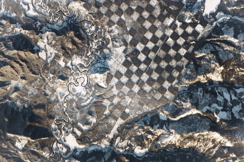
A distinctive checkerboard pattern alongside the Priest River in northern Idaho.

Photo credit:NASA
Checkerboard pattern just outside Phoenix, Arizona.
Photo credit:Reddit.com
Checkerboard pattern along the Idaho-Montana border, sandwiched between Clearwater and Bitterroot National Forests.
Photo credit:NASA
Sources:Cascadia Wildlands/Wikipedia/OSU Press/Wikipedia