Shortly after, the salt pan came to be known as the Devil’s Golf Course.
Known as Lake Manly, this body of water reached depths of 600 feet.
During this period the majority of the salts that comprise these formation entered the area.

This time the salt pan flooded to a depth of about 30 feet.
The climate warmed again, rainfall declined, and the shallow lakes began to dry up.
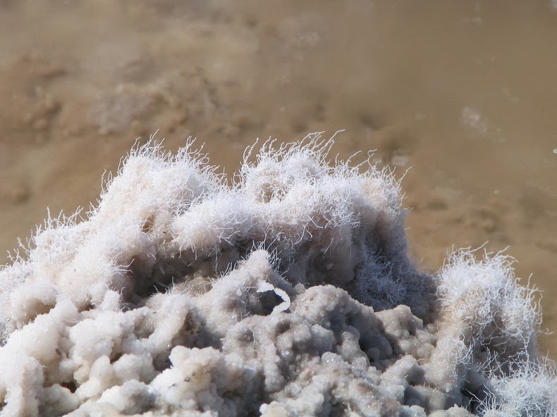
The pinnacles form when salty water rises up from underlying muds.

Capillary action draws the water upward where it quickly evaporates, leaving a salty residue behind.
The pinnacles grow very slowly, perhaps as little as an inch in 35 years.
Wind and rain continually sculpt the salty spires into fascinating shapes.

Source:Wikipedia,USGS,Geocaching